The Carrot River Valley Watershed participated in phosphorus testing over the past couple summers with the Lake Winnipeg Basin Fund Initiative. The North Saskatchewan River Basin Council, the South Saskatchewan River Watershed Stewards and Swift Current Creek Watershed Stewards have also been collecting water samples. The Lake Winnipeg basin is nearly 1,000,000 km² in size and is home to more than 7 million people.
Phosphorus is one of the many nutrients needed for healthy plant growth. Plants absorb the phosphorus from the soil to the extent that they need. The concern arises when there is an excess of phosphorus in the water. Herbicides, insecticides fertilizers etc. are used in agricultural and urban areas and this excess can lead to runoff into nearby waterbodies. When there is an increase in nutrients in waterbodies this can lead to Eutrophication. Eutrophication can cause many problems for the waterbody and for humans in some cases. With the Lake Winnipeg Basin Initiative, there will be records of what the Phosphorus levels are in the selected waterbodies. This data will allow further research analysis, and how to manage for our waterbodies in the following years.
The data is located on DataStream. For the link to get to the CRVWA call or email us and we can send the link to you. Water was collected for two summers at spring runoff and throughout the rest of the summer. The water was collected from the location sites and sent to the lab for analysis. This project has been completed.
This project was funded by Environment and Climate Change Canada.![]()
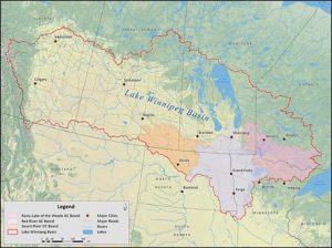
Lake Winnipeg Basin Size
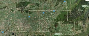
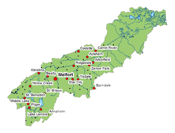
Location Sites:
Wakaw Lake LLD: NE-09-43-25-2
Gronlid LLD: NE-07-47-18-2
Armley LLD: NE-09-48-14-2
Pasquia LLD: SE-31-48-11-2
Smoky Burn LLD: NE-20-51-08-2
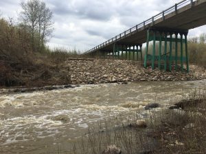
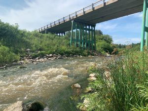
Water Sampling on Carrot River- Spring Runoff May 2020
Water Sampling on the Carrot River- August 2020
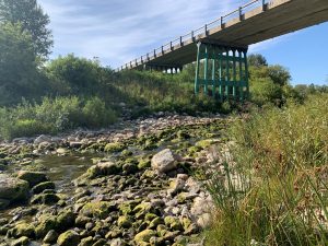
Water Sampling on the Carrot River- September 2020